Private · Trekking
Simien Mountains to Lalibela Grand Trek
From the edge of the escarpment to the roof of Ethiopia, then on to Lalibela.
- Duration
- 13 Days / 12 Nights
- Start & Finish
- Gondar – Lalibela
- Difficulty
- Challenging
- Pricing
- Price on request
The Journey
From the edge of the escarpment to the roof of Ethiopia, then on to Lalibela.
Walk from Sankaber through Geech and Chenek to Ambiko for a Ras Dashen summit attempt, then continue through Beyeda, Zhukzuke and Sekota to Lalibela. Six mountain camping nights lead into three nights of simple highland accommodation and three nights in Lalibela.
The trek is the first chapter; the remote northern highlands and Lalibela form the second. Two nights at Geech give the journey time to settle before the harder mountain stages.
- Who it is for
- Experienced hikers, photographers and travellers comfortable with basic camps, high altitude and remote highland travel.
- Consider another itinerary if
- Travellers seeking a short, easy walk or hotel accommodation throughout.
Places
- Gondar
- Simien Mountains
- Sankaber
- Geech
- Chenek
- Ambiko
- Ras Dashen
- Beyeda
- Zhukzuke
- Sekota
- Lalibela
Day by Day
The planned route
Exact timings, camp locations and access are confirmed for your dates.
Day 1
Gondar To The Simien Mountains
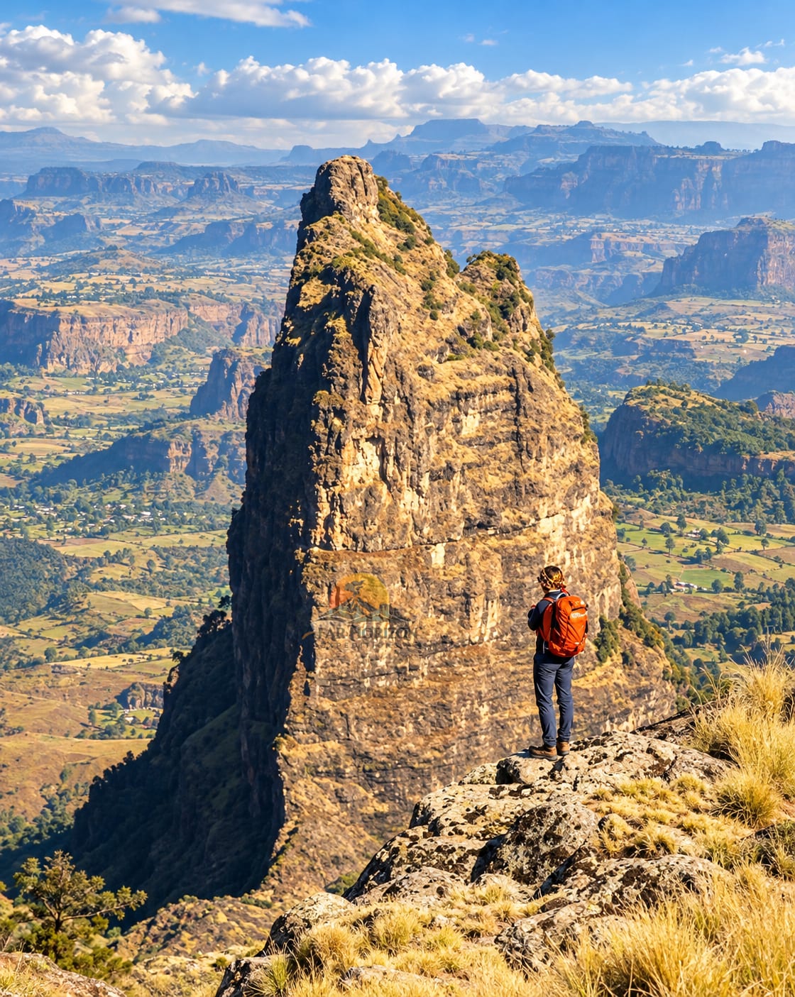
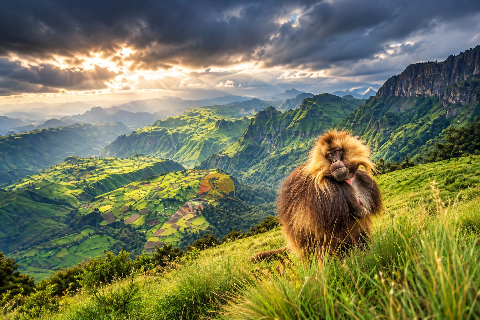
Gondar → Debark → Park Entrance → Sankaber Walking: Introductory mountain walk Altitude: Sankaber approximately 3,200–3,250 m Your expedition begins in Gondar. After breakfast, we leave the historic city and travel north toward Debark, the main gateway to the Simien Mountains. The road itself becomes part of the experience. Cultivated highlands gradually give way to rougher terrain. Villages appear between fields, livestock moves along the road and the temperature begins to change as we gain elevation. At Debark, the expedition team completes the necessary park arrangements and meets the local mountain support team. From here, the journey enters the Simien landscape. The first major views appear around the escarpment country near Buyit Ras and Sankaber. This is where the character of the trip changes. Instead of simply stopping for a photograph, we slow down and begin walking. The first hike is deliberately moderate. It allows your body to begin adjusting to altitude while giving you your first opportunity to understand the terrain. Gelada troops are frequently encountered in this part of the park. They are one of Simien's defining animals and are found naturally in the high grasslands and cliffs. As the afternoon light moves across the escarpment, the scale of the landscape becomes clearer. There are no buildings competing with the view. Just grassland, cliffs, distant peaks and enormous valleys. Evening: Dinner at camp and expedition briefing for the following trekking days.
- Overnight
- Sankaber Camp
- Meals
- Lunch, Dinner
Day 2
Into The Mountains
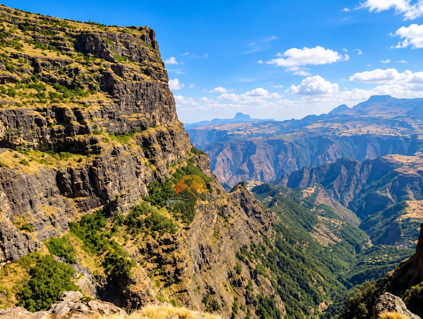
Sankaber → Jinbar River → Jinbar Waterfall → Geech Trekking: Full mountain trekking day Typical walking time: Approximately 5–6 hours, depending on route and conditions After breakfast, we begin walking deeper into the Simien Mountains. The trail follows the escarpment and eventually leads toward the Jinbar River system. One of the defining moments of this day is the Jinbar Waterfall, where water disappears dramatically into the enormous gorge below. The waterfall is not simply a viewpoint. It helps explain the landscape. The same erosion that created the waterfall has carved the Simien plateau into the extraordinary cliffs and valleys that define the national park today. UNESCO describes the park's cliffs as reaching around 1,500 metres in places and identifies the geological landscape as one of its outstanding universal values. After the waterfall area, the trail continues toward Geech. The vegetation changes as we climb. Giant lobelias begin appearing across the highland landscape, giving the surroundings an almost prehistoric character. Gelada troops may accompany sections of the route. Our guide does not simply point at wildlife. We explain the relationship between the animals, altitude, grasslands and people who have lived around these mountains for generations. Eventually Geech appears. This is one of the great Simien camps—not because of luxury, but because of its location. Evening: Hot meal, camp life and sunset over the escarpment.
- Overnight
- Geech Camp
- Meals
- Breakfast, Lunch, Dinner
Day 3
The Great Viewpoint Day
Geech → Imet Gogo → Saha → Kedadit → Geech Trekking: Full scenic acclimatization day Typical walking: Approximately 4–6 hours depending on selected viewpoints Today we do not move camp. That is deliberate. Instead, Geech becomes our base for exploring some of the most spectacular viewpoints in the Simien Mountains. We walk toward Imet Gogo, one of the most famous viewpoints in the park, at approximately 3,926 metres. The landscape opens progressively as we approach the viewpoint. From here, the escarpment falls away dramatically into deep valleys, while ridges and isolated peaks stretch toward the horizon. This is one of the places where photographs often fail to communicate scale. After Imet Gogo, we continue through the highlands toward additional viewpoints such as Saha and Kedadit, depending on weather, trail conditions and the group's strength. Lunch is taken in the mountains. The afternoon becomes slower. There is time for photography, wildlife observation and simply sitting above the valleys. The possibility of seeing gelada is high in suitable areas. Walia ibex, Ethiopian wolf and other highland wildlife are possible but never guaranteed. Simien is globally important for these endemic species. We return to Geech for another night. This second night is valuable: it gives your body additional time at altitude before the route becomes harder.
- Overnight
- Geech Camp
- Meals
- Breakfast, Lunch, Dinner
Day 4
Geech To Chenek
Geech → Enatye Escarpment → High Mountain Country → Chenek Trekking: Challenging Typical walking: Approximately 6–8 hours depending on route Today the mountains become more severe. We leave Geech and continue eastward through the high Simien plateau. The trail passes through open highland landscapes where the vegetation becomes increasingly adapted to altitude. We approach the dramatic Enatye area and continue toward Chenek. This is one of the sections where the expedition begins to feel genuinely remote. The trail repeatedly moves between open plateau and dramatic escarpment viewpoints. Clouds can move quickly across the mountains, changing the character of the landscape within minutes. Wildlife watching remains an important part of the day. Chenek is particularly significant for the possibility of seeing Walia ibex, the endemic mountain goat found only in the Simien Mountains. Late afternoon brings us toward Chenek Camp. The location is spectacular. Rather than rushing through the campsite, we use the remaining daylight to look across the ridges and valleys and prepare for the much more demanding stage ahead.
- Overnight
- Chenek Camp
- Meals
- Breakfast, Lunch, Dinner
Day 5
The Great Descent And Ascent
Chenek → Bwahit Pass → Mesheha Valley → Ambiko Trekking: Very challenging Typical walking: Approximately 8–10+ hours depending on conditions and group pace This is one of the most important days of the expedition. The route changes dramatically. From Chenek, we climb toward the high Bwahit country, reaching elevations around 4,200 metres depending on the exact route. The mountain environment becomes more exposed. Then comes the great descent. We drop toward the Mesheha valley. This is what makes a Ras Dashen expedition different from simply driving to a high viewpoint. You lose altitude. Then you have to earn it again. The route descends through rugged mountain terrain toward the river system before climbing again toward Ambiko. This is physically demanding, and the guide sets the pace according to the group rather than chasing a clock. Lunch is carried as a mountain meal and taken along the route. As the afternoon progresses, Ambiko becomes increasingly important. This is the traditional staging area for the Ras Dashen summit. When we arrive, the mountain team prepares camp and organizes equipment for the following day's summit attempt. Dinner is early. The evening is intentionally quiet. Tomorrow is the mountain's main test.
- Overnight
- Ambiko Camp
- Meals
- Breakfast, Lunch, Dinner
Day 6
Ras Dashen Summit Day
Ambiko → Ras Dashen → Ambiko Trekking: Very challenging Highest point: Approximately 4,550 m The day begins before sunrise. There is no need for a dramatic speech. The mountain is already there. We begin the ascent from Ambiko while the air is cold and the landscape is still dark. The route climbs gradually before becoming steeper. At this altitude, pace matters. The goal is not speed. The goal is consistency. Our guide watches breathing, energy and altitude response throughout the climb. The final approach is a mountain experience rather than a technical mountaineering expedition under normal conditions, but the altitude and length make it demanding. Eventually the summit area of Ras Dashen, Ethiopia's highest mountain, comes into view. The summit is approximately 4,550 metres. For a few minutes, the entire expedition seems to compress into one moment. Behind you are the valleys, escarpments and camps you have crossed on foot. Ahead is the enormous Ethiopian highland horizon. After time at the summit area, we begin the descent. The descent is not treated as an afterthought. At altitude, tired legs can make the return journey demanding. We return to Ambiko for dinner and another night in camp. Achievement: Summit of Ras Dashen.
- Overnight
- Ambiko Camp
- Meals
- Breakfast, packed lunch, Dinner
Day 7
Leaving The High Mountain Core
Ambiko → Remote Highland Trail → Beyeda Area Trekking/Transfer: Challenging transition day The summit is behind us. Today begins the second chapter of the expedition. Instead of simply reversing the entire trekking route back to Gondar, we continue through the northern highlands. The landscape gradually changes. The huge central Simien escarpments begin to give way to more open mountain terrain and remote settlements. This is where the journey becomes less about famous viewpoints and more about seeing how people actually live in the Ethiopian highlands. Depending on the final operational route, walking sections are combined with local road transfers to connect the mountain trail with the next accessible settlement. The route is intentionally flexible because this is remote Ethiopia: road conditions, local access, weather and vehicle availability can influence the exact connection. By the time we reach the Beyeda area, the expedition feels different from the first days in the park. The mountain story is becoming a human story.
- Overnight
- Beyeda
- Meals
- Breakfast, Lunch, Dinner
Day 8
Through The Remote Northern Highlands
Beyeda → Zhukzuke Style: Highland travel, walking and road transfer Today is intentionally different. There are no famous international attractions to tick off. That is exactly why we include it. We travel through remote northern highland landscapes where agriculture, livestock, stone houses and mountain roads tell a quieter story of Ethiopia. Where conditions permit, we make short walks away from the vehicle to experience the countryside at human speed. Our guide explains the relationship between altitude, rainfall, agriculture and settlement. The further we move away from the Simien tourist circuit, the less the journey feels like a conventional trekking holiday. This is northern Ethiopia as a lived landscape. We continue toward Zhukzuke. The overnight is simple and local.
- Overnight
- Zhukzuke
- Meals
- Breakfast, Lunch, Dinner
Day 9
Zhukzuke To Sekota
Highland Villages → Sekota Style: Scenic transfer with cultural stops We continue south/east through the highland transition toward Sekota. The landscape gradually becomes drier. The vegetation changes. The architecture changes. The road becomes part of the expedition again. Sekota provides an important geographical transition point between the mountain environments and the drier northern highlands. Rather than presenting the journey as “just a transfer,” our guide interprets what we see along the way—farmland, settlements, seasonal water, livestock and the changing landscape. Arrival in Sekota is followed by time to rest. After several nights of camping and mountain trekking, a proper bed and shower are welcome.
- Overnight
- Sekota
- Meals
- Breakfast, Lunch, Dinner
Day 10
Sekota To Lalibela
From the Highlands to the Rock-Hewn World Transport: Private vehicle Today marks one of the most dramatic transitions of the entire journey. We leave the remote highlands and travel toward Lalibela. The road winds through increasingly dramatic terrain. The landscape becomes drier and more sculpted. Eventually Lalibela appears as something completely different from the mountain world we have just left. The first impression is often surprising. Lalibela is not simply an archaeological destination. It is a living religious landscape. After arrival and check-in, we allow the afternoon to remain relatively relaxed. If arrival conditions permit, we take a first orientation walk and introduce the history and spiritual importance of Lalibela before the full church exploration begins.
- Overnight
- Lalibela
- Meals
- Breakfast, Lunch, Dinner
Day 11
Lalibela’s Living Rock
Eastern Church Complex Today we slow down. After nearly two weeks of mountain travel, Lalibela deserves time. We begin exploring the famous rock-hewn churches with a local specialist guide. The churches are not simply monuments carved into stone. They remain active places of worship. We therefore approach them as living religious spaces, observing local customs and giving worshippers priority. The architecture reveals a completely different side of Ethiopia's history. Instead of building upward with stone blocks, the medieval builders worked downward into the living rock. We take time to understand how the churches were conceived, carved and connected. The guide explains the symbolism, traditions and stories associated with the site rather than simply giving names and dates. Afternoon is kept flexible. There may be time for photography, a local coffee experience or quiet exploration around town.
- Overnight
- Lalibela
- Meals
- Breakfast, Lunch, Dinner
Day 12
Lalibela Beyond The Postcard
Northern & Southern Church Areas + Local Life A second full day allows us to experience Lalibela without rushing. We continue with additional churches and religious sites according to current access and the group's interests. Where appropriate, we explore the surrounding landscape and local community. This is important because Lalibela's story is not contained entirely inside the churches. The surrounding highland landscape explains why this location became such an important religious centre. We leave space for conversation. For coffee. For photographs. For observing daily life. For travelers who have spent the previous days trekking, this day also provides a natural conclusion to the physical journey. The expedition has moved from walking across mountains to understanding one of Ethiopia's greatest cultural landscapes.
- Overnight
- Lalibela
- Meals
- Breakfast, Lunch, Dinner
Day 13
The Journey’s Final Morning
Lalibela → Departure / Onward Journey There is no need to fill the final morning with unnecessary sightseeing. Breakfast is followed by time for a final walk, photographs or local shopping depending on departure time. Your guide assists with the transfer to Lalibela Airport or your onward connection. And then the expedition ends. But the route leaves you with something unusual: You have not simply visited Simien. You have crossed it. You have walked from the escarpment to the high valleys. You have stood on Ethiopia's highest mountain. You have travelled through remote northern communities. And you have finished among the churches of Lalibela. Trip ends in Lalibela.
- Overnight
- No overnight
- Meals
- Breakfast
Operating subject to current access and conditions
Mountain weather, trail access and guest wellbeing can change the route. Camps, transport, support equipment and any summit attempt are confirmed for your dates. Wildlife sightings and reaching a summit are never guaranteed. The remote highland connections and Lalibela visits require a confirmed local route.
What Is Included
- Private transportation from Gondar to the Simien and onward to Lalibela, as quoted
- Professional mountain guide, required scout and park entrance arrangements
- Camping equipment and camp accommodation for the stated trekking nights
- Trekking cook, camp meals and mule support where applicable
- Drinking water according to the confirmed itinerary
- Hotel pickup, route planning and basic first-aid support
- Highland accommodation including Sekota and Lalibela hotel nights as confirmed in the quotation
- Lalibela local guide according to the confirmed itinerary
Not Included
- International and domestic flights
- Ethiopian visa
- Travel insurance and personal medical expenses
- Alcohol, personal shopping and tips
- Personal trekking equipment
- Additional hotel nights and unplanned private transfers
- Voluntary itinerary changes and activities not specifically listed
- Personal sleeping bag if not supplied, laundry and camera/video fees
- Emergency evacuation or rescue costs not covered by insurance
Safety First
How we keep you safe
Conditions checked before every departure
We review current access, local information and official travel advice before we quote and again before you leave. If a route is not appropriate, we change or cancel it.
Experienced local Afar guides
Danakil expeditions are led by local Afar guides who know the ground, with scouts and escort arrangements where required.
Planned around the heat
Days start early, the hottest hours are for rest, and water is planned for every day of the route.
Our own team and 4×4 vehicles
Our own guides, drivers and field staff run the journey. One team is responsible for the whole ground operation.
Designated safe areas only
At Dallol and Erta Ale your guide decides on the day how close it is safe to go, and the group stays within designated safe areas.
Honest, constant communication
If something changes, we verify it on the ground, explain what it means for you, offer realistic options and choose the safest one.
Before you go
Questions travellers ask
- Can I choose a Ras Dashen trek without altitude experience?
- Tell the team about your walking experience, previous time at altitude and available days before selecting a route. Summit itineraries are demanding; the guide may change the plan according to weather and guest wellbeing.
- What support is arranged?
- Your quotation confirms the guide, required scout, transport, camp equipment, cook, meals, water and pack support applicable to your route. Bring personal trekking equipment and tell us about dietary requirements before departure.
Enquire
Make Simien Mountains to Lalibela Grand Trek yours
Send us your dates and group size. We will check current conditions, confirm the route and send a clear quotation before you commit to anything.
13 Days · Private Price on request
Other Expeditions
You may also be weighing up
Speak With a Designer
Questions before you enquire?
Heat, road time, how hard the walking really is, what camping means in the Danakil. Ask us anything and we will answer honestly.
Or call us directly on +251 956 61 6969